
Interpretation limit
Adding export pixels creates no new observations. A screenshot may omit measurement resolution or overlay information.
Public sources / INT
Browse Earth observation layers and compare dates or phenomena. Record the layer name, date and displayed area; retain the legend to explain the screenshot’s colours.

AI-generated illustration
Read this source in practice
Worldview Snapshots offers layer, UTC date, extent, projection, resolution and format choices. These describe the requested image and should accompany evidence captures.
Adding export pixels creates no new observations. A screenshot may omit measurement resolution or overlay information.
Layer, identified product, date, extent, projection, format and export settings.
A fictional 100 km width over 1,000 pixels gives roughly 100 m per export pixel. It does not prove native measurement at 100 m.
Consulted reference : NASA — Worldview Snapshots parameters · Consulted on
Updated on :
The reference documents the reading method. The example is fictional; this note does not attest a portal test today or a mission outcome.
Apollo 17’s Earth photo offers a concrete case: identifying a photograph does not date the story attached to it. The date of a page republishing it and the capture date are separate facts.
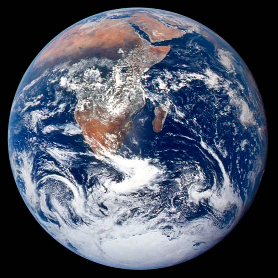
Real documentary case, consulted on 2026-10-14. Resized and encoded WebP version, with no crop or AI retouching.
Earthrise lets us compare three documented dates. The photograph is real; the two official records give its context.
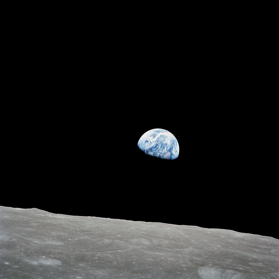
Republication in 2024 does not make this a photograph taken in 2024. Retain the capture date and the reference for each consulted page.
It dates your access to a source. It replaces neither capture nor publication and does not prove the page was identical earlier.
Sources consulted on . WebP version resized from the NASA-supplied file, without cropping or AI retouching.
Record sensor, acquisition date, product and processing. Two views of one satellite product are not independent acquisitions.
Browse Earth observation layers and compare dates or phenomena. Record the layer name, date and displayed area; retain the legend to explain the screenshot’s colours.
A coloured visual depends on its layer and is not itself a ground measurement.
Layer name, stated instrument, selected day, extent and visualisation settings.
Compare identical settings; a changed palette may create a false impression of change.
Access, download and API conditions depend on the service. Consult the official documentation and the resource terms.
Compare map landmarks, satellite acquisitions and observation layers with their dates.
Views with different resolutions and processing cannot be treated as identical photographs.
Compare sourcesFix area and dates, open USGS and Copernicus scenes, then use NASA Worldview to place the change in context.
Sensors, resolution, cloud cover and processing differ; similar colors do not prove identical ground conditions.
Compare sourcesInspect the exact resource and its terms. Being viewable does not authorise redistribution; retain the resource licence and restrictions instead of inferring them from the portal.
Record consultation date, covered period, last update and version separately. For revised data, retain the file or exact extraction reference.
The web page, export and API may differ in coverage or terms. Check pagination, filters, authentication, quotas and licence for the access method used.
Check each layer’s terms and required attribution. Inclusion in a viewer does not automatically give identical rights for every basemap and product.
Align area, acquisition, sensor, resolution and rendering. Check clouds and masks locally; different palettes or composites can create visual differences.
Verify the context of a public imageDOCUMENTED REFERENCE
Worldview uses GIBS visualizations. To retain an image as evidence, identify the layer and processing source, not just the selected day. These terms belong to GIBS services; their effects depend on the available layer.
| Reference | Value or form | What it identifies |
|---|---|---|
| std | STD | The std endpoint exposes standard- or science-quality visualizations. It does not mean a product exists for every possible date. |
| nrt | NRT | The nrt endpoint exposes near real time. It describes production latency, not continuous observation of a place. |
| best | Best Available | A Best Available layer combines versions and latencies. The usual priority is latest standard, latest NRT, then older products; the provider defines the choice. |
| Time | UTC | In WMTS, omitting time uses the default date advertised by the layer. Subdaily layers also require a UTC time; a day alone is not an acquisition instant. |
| TileMatrixSet | WMTS | This identifier describes a visualization tile grid. Do not confuse zoom level, rendered tile spacing and scientific-product resolution. |
The same Best Available layer can return a different source when better products become available. For reproducibility, retain requested and consultation dates, layer identifier, explicit version and latency, projection and extent.
No. NASA notes that acquisition or processing may not yet have occurred. Examine layer availability and underlying data before interpreting an absent image.
Documentation consulted on .
DEEPER READING / PRACTICE
A list indicates where to look for and what limits to keep in mind. It helps to prepare a consultation but does not replace the reading of the obtained document.
Updated on .
Select a precise question, open the source and raise the request, result and date. Compare the possibilities announced with the information actually available at the time of the consultation.
The availability of a service and its content may vary. The directory does not turn an absent, partial or ambiguous result into a definitive response.
The consultation report documentes the search path, document found, useful elements and reserves. The result is included in the file with its origin.